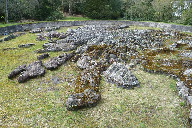
The Great Polish Map of Scotland, also known as the Mapa Scotland, is a large three-dimensional, scale model of Scotland, with lakes, mountains and sea, sculpted in concrete and located in the grounds of the Barony Castle Hotel, outside the village of Eddleston near Peebles. Built between 1974 and 1979, to a scale of 1:10,000, it is possibly the largest terrain relief model in the world.
The large concrete map was the idea of Krakow-born war veteran Jan Tomasik, a sergeant in the 1st Armoured Division, who during the Second World War was stationed in Galashiels, about 22 km from the castle. Like many Polish soldiers, Tomasik refused to return to Poland after the war and the Communist take-over, fearing his personal freedom would be curtailed. He married a Scottish nurse who had treated him and settled in Scotland. He bought the hotel at Black Barony in 1968 and became a successful hotelier in Edinburgh.
Tomasik was fascinated by a large scale-model map of Belgium, which he saw at the Brussels World's Fair of 1958 on his way to visit relatives in Poland. This apparently inspired him to create something similar in the grounds of Barony Castle, as an added attraction for his hotel guests. Tomasik told his hotel patrons that he wanted to show the country the Poles had defended during the war and that he hoped Queen Elizabeth, consort of King George VI, would officially open the map. On more than one occasion, Tomasik is remembered to have said that he wanted the map to be his legacy describing it as a gift to the Scottish people for the hospitality they had shown the Poles during the war years.
In the early 1970s, Tomasik met Professor Mieczyslaw Klimaszewski, head of the Institute of Geography at the Jagiellonian University of Krakow and proposed his idea of creating a large physical relief map of Scotland in the grounds of his hotel. Cartographer Dr. Kazimierz Trafas took charge of the design work and accompanied by a small group of Polish exchange students seeking casual summer employment, arrived in Scotland.
An area measuring 50 meters by 40 meters lying in an oval pit was selected. The topsoil was removed and the shapes of the mainland and islands were marked out to a scale of 1:10,000. Then three contour lines of 300, 600 and 900 meters were laid in brick courses with vertical shuttering to contain the concrete infill. The body of the map was then gradually built up, followed by the difficult task of manually sculpting the terrain. Mountain summits were marked by vertical wooden rods, their height exaggerated five times to enhance the visual impact. Finally, after six consecutive summers between 1974 and 1979, the sculpture was complete. The topography was finished off with coat of resin compound and paint. Geographical features were added by painting forests, urban areas, rivers and major roads. The oval basin was filled with water to create the seas. Hidden pipes supplied water for the major rivers.
After the hotel closed in 1985 the map fell into neglect and disrepair. In 2010, a group of volunteers calling themselves Mapa Scotland was formed dedicated to task of saving the map from further decay and restoring it to its former condition. In 2012, the map was granted listed status by Historic Scotland. The map is still under restoration.


West Coast of Scotland, the Great Polish Map of Scotland. Photo credit
Restoration work on the map. Photo credit
Sources: Wikipedia / www.mapascotland.org
Related
Gigantic Scale Model of Shanghai
World's Largest Scale Model of the Solar System Covers Entire Sweden


What a wonderful gesture and work. Well done
ReplyDelete