Howland Island is an uninhabited coral island located just north of the equator in the central Pacific Ocean, about 3,100 km southwest of Honolulu. This flat sliver of land 2 km long and half-km wide is best known as the island the famous aviator Amelia Earhart was supposed to land on for refueling before continuing on her round-the-world flight. The plan was to arrive at Howland Island from New Guinea with her navigator Fred Noonan, replace him with another navigator Captain Harry Manning, and continue to Australia from where she would proceed on her own for the remainder of the project. Earhart’s plane never arrived, although her transmission was received on Howland Island. After her disappearance on July 2, 1937, the United States government, under whose possession the island was since 1856, built a lighthouse on the island as a memorial to the woman flier. Unfortunately, the short lighthouse called Earhart Light, today stand disused and in disrepair.

Howland Island sign with daylight beacon "Earhart Light" in background. Photo credit
Earhart Light is not an actually lighthouse, because it has no illumination. It is a day beacon or navigational landmark shaped somewhat like a short lighthouse, painted with wide stripes and meant to be seen from several miles out to sea during daylight hours. It is located near the boat landing at the middle of the island’s west coast.
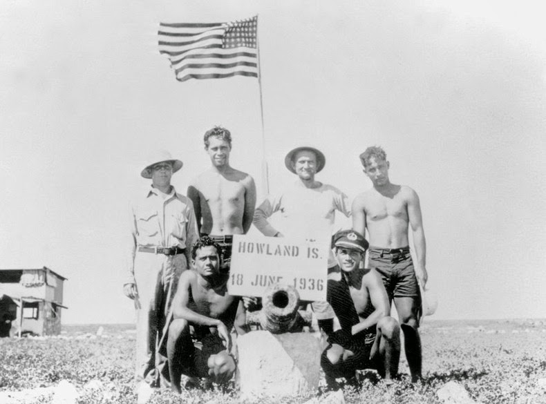
Originally the lighthouse was intended to be manned, and perhaps even illuminated. At that time, Howland Island had a small settlement by the name of Itascatown and was well connected with other equatorial Line Islands. The island had a half-dozen small wooden huts and the fledging colonists fed on canned food and water, and had other supplies including a gasoline powered refrigerator, radio equipment, and medical kits. The settlers were instructed to gradually develop a rudimentary infrastructure on the island, including the clearing of a landing strip for airplanes. It was hoped that with passing years a fair-sized population would spring up on the islands as they become important air bases for trans-Pacific flights.
When World War 2 broke out, the Japanese started bombing the island and destroyed what little the island had including Amelia Earhart’s lighthouse. The two remaining survivors were evacuated and a battalion of the United States Marine Corps took possession of the island until 1944. After the war, all attempts at habitation on the island were abandoned. Earhart Light remained broken for nearly two decades until it was repaired in early 1960s by the U.S. Coast Guard. No further restoration had happened since that time. Today, the Earhart beacon is said to be crumbling and hadn't been painted in decades.
Howland Island is now managed by the U.S. Fish and Wildlife Service and the island, along with the surrounding 129.80 square km of submerged land is considered a National Wildlife Refuge.
Howland Island lighthouse, circa 1939. Photo credit: U.S. Coast Guard
Howland Island lighthouse damaged during WW2, circa 1942 (left). Lighthouse restored in 1964 (right). Photo credit: U.S. Coast Guard
Howland Island lighthouse in 2008. Photo credit

Howland Island colonists. Photo credit
Howland Island’s crumbling runway. Photo credit
Plane Wreckage on Howland Island. Photo credit
Sources: Wikipedia / The Day – Issue Nov 17, 1937 / University of North Carolina


